Business Details
Professional Aerial Photography & 3D Visualisation Services
Established with a passion for visual storytelling, Tiptography specialises in aerial photography, 3D visualisation, and event coverage. Our CAA-approved pilots combine technical expertise with creative vision, delivering tailored solutions for diverse projects. With over eight years of experience, we prioritise client collaboration, ensuring every brief is met with precision and innovation. Our teams dedication to quality is reflected in our 5-star reputation and commitment to quick turnaround times.We integrate environmentally conscious practices into our operations, aligning our mission to create value while inspiring sustainable solutions. Clients consistently highlight our professionalism, technical proficiency, and ability to transform concepts into immersive visual experiences.
Services
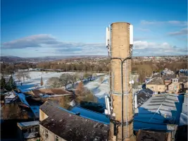
UAV Survey
Image Processing
Content Creation
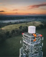
Aerial Capture
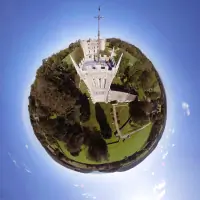
Virtual Tours & 3D Models
Sports & Events Coverage
Highlights and features
- 8 Years Experience in aerial imaging and 3D visualisation
- 5 Star Rating for client satisfaction and service quality
- Quick Turnaround times without compromising technical precision
- Dedicated Support throughout every project phase
- CAA-Approved Pilots ensuring regulatory compliance and safety
Associations and certifications
- CAA
What people say
Professional and experienced
Pleasure to work with
Quick turnaround
Dedicated support
5 Star Rating
Services
UAV Survey
Our UAV surveys capture high-resolution aerial data for construction, land management, and infrastructure projects. Using advanced drones and photogrammetry, we generate precise topographical maps and 3D models. Clients benefit from cost-effective, scalable solutions with rapid data acquisition and detailed reporting.
Virtual Tours
We create immersive virtual tours and interactive 3D models using 360 imagery and photogrammetry. Ideal for real estate, tourism, and cultural heritage sectors, these digital experiences allow users to explore spaces remotely. Our deliverables include customisable platforms with intuitive navigation and high-fidelity visualisation.
Sports Coverage
Specialising in sports and event photography, we document competitions, festivals, and corporate functions with dynamic aerial and ground-level footage. Our team ensures seamless coverage of key moments, delivering edited highlights and raw footage packages. Clients receive broadcast-quality content for marketing or archival purposes.
Image Processing
Our image processing services convert raw aerial data into actionable insights. Using industry-standard software, we perform orthomosaic stitching, volumetric calculations, and vegetation analysis. This service supports sectors like agriculture, mining, and environmental monitoring with accurate, quantifiable results.
Content Creation
We produce tailored visual content for marketing, education, and storytelling. From cinematic drone reels to interactive web assets, our content enhances digital campaigns and brand narratives. Clients receive end-to-end support, including concept development, production, and post-processing.
Questions
What areas do you cover for aerial surveys?
We operate across Cheltenham, Gloucestershire, and nationwide locations. Our UAV capabilities allow efficient coverage of urban, rural, and challenging terrains.
Are your pilots CAA-approved?
Yes, all our drone pilots hold CAA approval. We adhere to strict safety protocols and regulatory standards for all commercial operations.
How long does a typical project take?
Project timelines vary by scope. Surveys and basic edits typically complete within 3-5 working days. Complex 3D models or event coverage may require additional time, confirmed during briefing.
Can you create custom virtual tour platforms?
Yes, we develop bespoke virtual tour interfaces with branding, navigation tools, and interactive features. Clients receive full functionality across desktop and mobile devices.
What formats do you deliver media in?
We provide high-resolution video (4K/HD), still images (RAW/JPEG), and 3D models (OBJ/GLB). Delivery includes cloud links or physical storage upon request.